Amawalk Friends Meeting House is located on Quaker Church Road in Yorktown Heights, New York, United States. It is a timber frame structure built in the 1830s. In 1989 it and its adjoining cemetery were listed on the National Register of Historic Places.
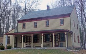
Quakers had been active in north central Westchester County since the mid-18th century. The current meeting house was the third they built; fire destroyed both predecessors. Not only is it one of the most well-preserved and intact in the county, it is a rare surviving meeting house built by a Hicksite meeting during that schism in American Quakerism.
Architecturally the meeting house shows some signs of Greek Revival influence, also unusual for Quaker buildings. The addition of a porch later in the 19th century also brought in some Victorian touches, again unusual. Its interior was renovated and the building resided when meetings were revived after a brief period of dormancy. However, many of its original furnishings remain.
Taking up most of the property is the meeting’s cemetery, which contains many graves of its members from the earlier years, along with that of Robert Capa, the accomplished mid-century war photographer, and his brother Cornell, although neither were members of the meeting, much less Quakers. The headstones of those graves strongly reflect Quaker burial practices, and thus the cemetery is included in the listing as a contributing resource. An architecturally sympathetic First Day School building added when meetings resumed in the 1970s is non-contributing due to its newness.
The 2.9-acre (1.2 ha) lot on which the meeting house, First Day school and cemetery are located is on the west side of Quaker Church Road, also at that point the boundary between the towns of Yorktown and Somers to its east. It is located 0.3 miles (500 m) north of Quaker Church’s southern end at Saw Mill River Road (also U.S. Route 202,New York State Route 35 and New York State Route 118). This area was formerly the hamlet of Amawalk, which still lends its name not just to the meeting house but to theAmawalk Reservoir, part of the New York City water supply system, a half-mile (800 m) to the east.
Topographically the area consists of small low hills with occasional narrow depressions, often filled by creeks or wetlands, in between. The meeting house property slopes upward to the west, draining into the valley of an unnamed tributary of Hallocks Mill Brook, a tributary of the Muscoot River, which drains Amawalk Reservoir on its way toMuscoot Reservoir. Its neighborhood is residential, with most houses on large mostly wooded lots.
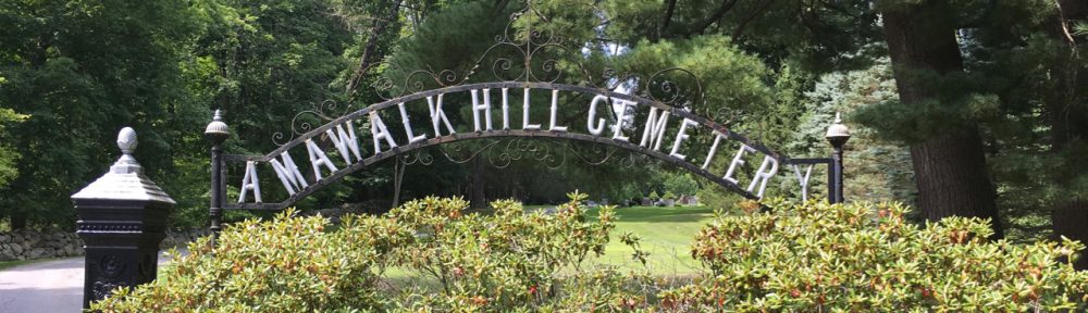
Across Quaker Church are two houses on such lots. Behind them is a cleared power line right-of-way closely paralleled by the North County Trailway rail trail. To the meeting house’s west is Amawalk Hill Cemetery, with another cemetery, Carpenter Hill, to the north, buffered by a woodlot.